
Winter Storm Warning Issued For Quad Cities Area


A massive snow storm is approaching the Quad Cities area and forecasters are predicting high snow fall totals, and blustery winds.
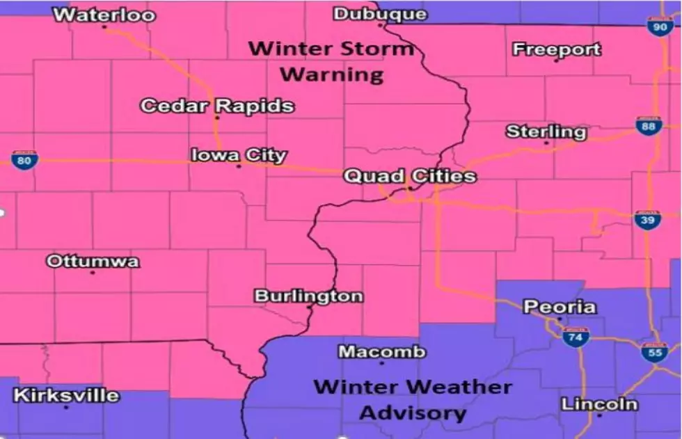
This morning, the National Weather Service upgraded all of the Quad Cities area from a Winter Storm Watch to a Winter Storm Warning. That warning will go into effect at noon today, and last until noon tomorrow (Tuesday).
According to the National Weather Service, a powerful storm system will bring heavy snow, strong and gusty winds, mixed freezing rain and snow, and blowing and drifting snow to the area Monday afternoon, through Tuesday morning.
Snow will slowly spread north through the day, reaching Interstate 80 and the Cedar Rapids to Quad Cities metro areas between 3 and 5 p.m. this afternoon. Farther north, after a mainly dry afternoon snow will arrive towards the evening commute along Highway 20 in Iowa and Illinois.
Most of eastern Iowa and northwest Illinois will see 6 to 12 inches of heavy snow, with blowing and drifting snow tonight.
Right now, forecasters are saying the heaviest snowfall can be expected within a band roughly along I-80 in Iowa and I-88 in Illinois.
Travel this evening is not advised. If you have to travel tonight, the National Weather Service says keep an extra flashlight, food, and water in your vehicle in case of an emergency.
More details can be found in the social media post below.
Why Kids Need A Pet
More From I-Rock 93.5


