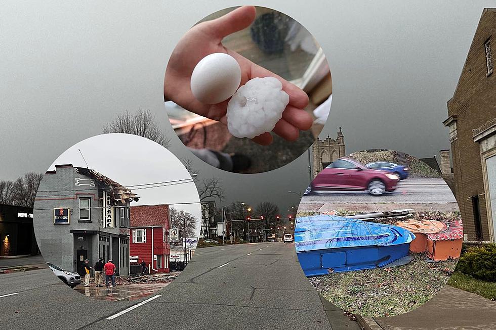
PHOTOS: Quad Cities Gets Severe Damage From Early Tuesday Morning Storms
Early Tuesday morning, a strong severe storm impacted the Quad Cities area on both the Iowa and Illinois sides. The Illinois side of the Quad Cities, including Rock Island and Moline, saw most of the extensive damage in the area.
The storm looked like it was going to impact more of the Iowa side of the Quad Cities from the start, but a microburst over Rock Island County appears to be the reason for the damage and power outages on the Illinois side of the Quad Cities.
Round 1 Of Tuesday's Storms
Early Tuesday morning, the KWQC TV-6 First Alert Weather team and the National Weather Service of the Quad Cities began tracking a developing severe storm near Ottumwa, IA at about 7:50 a.m. That storm reached the Quad Cities metro around 9 a.m. on Tuesday bringing with it strong winds up to 50 mph and baseball and golf-ball-sized hail.
What wasn't expected was the microburst over Rock Island County. What is a microburst? This is the definition from the National Weather Service:
A microburst is a localized column of sinking air (downdraft) within a thunderstorm and is usually less than or equal to 2.5 miles in diameter. Microbursts can cause extensive damage at the surface, and in some instances, can be life-threatening.
That microburst brought wind speeds of 60+ mph to the cities of Rock Island, Moline, East Moline, Colona, Geneseo, and other towns causing extensive damage. The large hail also caused damage to property throughout the area.
This is only round 1 of potential three rounds of severe storms for the Quad Cities area for the next 24 hours.
Power Outages On The Illinois Side
At one point, almost 19,000 MidAmerican customers on the Illinois side of the Quad Cities lost power because of this severe storm.
Several power lines are reported on the ground, utility poles are snapped in half, roofs ripped off, trees uprooted, tipped over semi-trucks, and so much more damage is being reported in the area. Most of it is on the Illinois side of the Quad Cities.
On the Iowa side, this storm brought large hail too with hail sizes ranging from .5 inches to almost 3 inches in size. That is hail the size of tennis balls and baseballs falling from the sky.
Below are photos from throughout the Quad Cities of storm damage from just the first round of potential three rounds of severe storms in eastern Iowa, the Quad Cities, and northwestern Illinois within the next 24 hours.
If you have photos, click here to submit them on our app or click here to email them to us.

